


Click 'Get Pricing' to add this to a quote and access pricing information. After submission, get a response within 3 business days.
Space intelligence, made visible
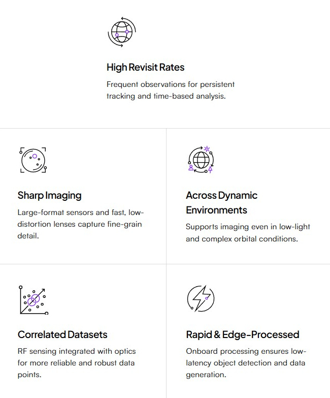
IRIS provides high-resolution non-Earth imaging (NEI) and satellite RF signature mapping using advanced space-based sensors. Engineered to identify, characterize, and monitor the behavior of space objects, this platform leverages precise and prompt detailing to give clearer insights even in low-light conditions.
What IRIS delivers:
-
- Identification
- Rapidly detect and classify new satellites, debris, and other space objects.
- Mensuration & Characterization
- Measure the size, geometry, configuration, and power output of observed objects.
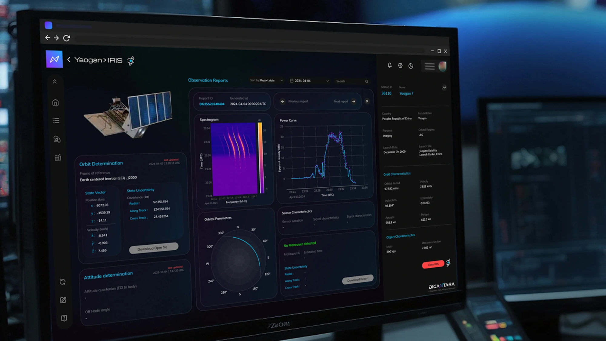
- Orbit Determination
- Generate precise state vectors of an object's orbit as TLEs, OPMs, and OEMs for trajectory information.
- Attitude & Tumble Rate
- Determine orientation, pointing direction, and rotational behavior to access object health and activity.
- RF Observation Reports
- Detect and correlate RF emissions to determine function, analyse behavior, and support characterization.
- 3D Modelling
- Construct realistic 3D representations of RSOs by combining high-res optics with open-source data.
- Identification
Why IRIS stands apart
How IRIS operates
Secure Delivery
Data delivered as custom on-demand reports, or an API, or through a secure air-gapped SDK.
Seamless Integration
Seamlessly integrates into your Common Operating Picture (COP), mission planning platforms, or any custom data dashboards.
Real-time & Automated
Supports real-time tasking and automated backend ingestion to deliver timely, actionable intel when you it.
| Type | Document Name | Action & Size |
|---|---|---|
| No public documentation available. Please inquire for details. | ||

